Eoghan and Mhari Bain - zipwire and tree hut with garden.jpg1.76 MB
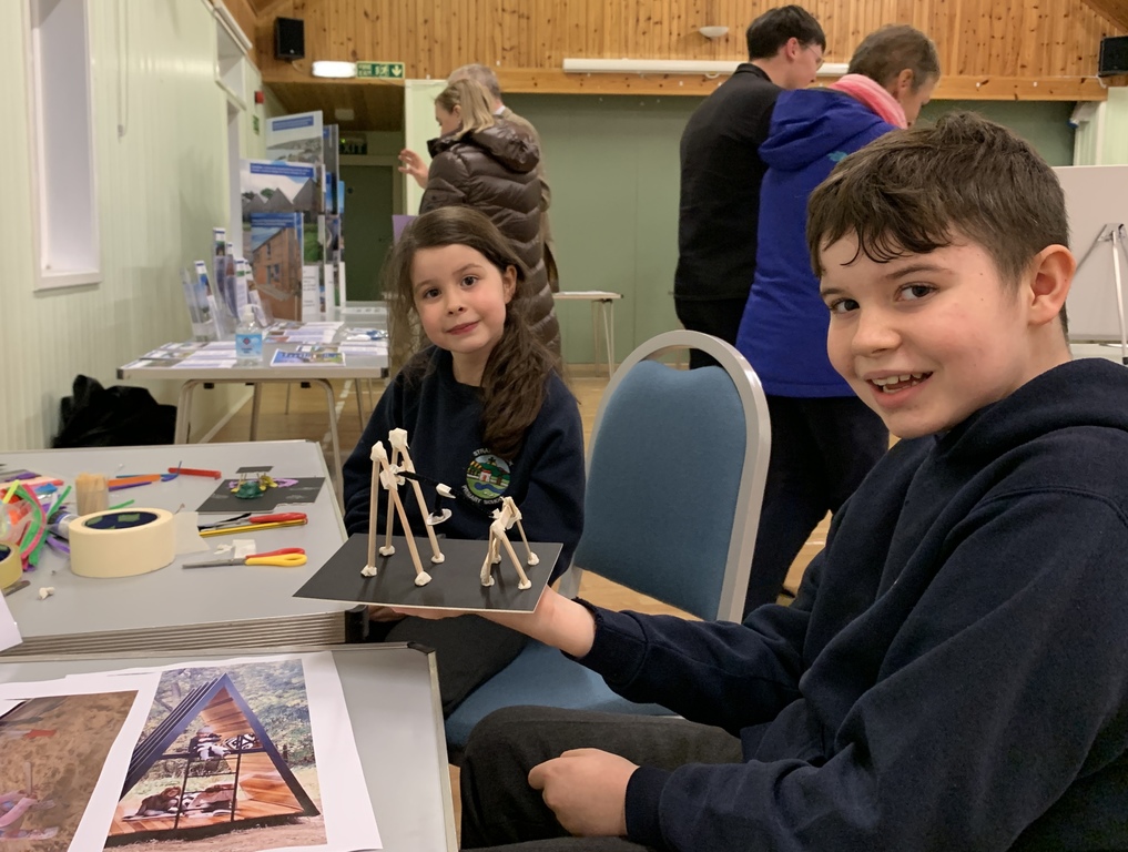
Interested in seeing what the 126 visitors to the various November community events suggested for the Local Place Plan?
Check out this report that explains more about the events and transcribes every single written comment that was received. We're now using that wealth of information to prepare a draft Local Place Plan, building on last year's Community Action Plan.
If you're prompted to think of more ideas, let us know. Please email or call Nick Wright by the end of the second week in January; contact details are at the very bottom of this page.
We're aiming to publish the draft Local Place Plan in late January for you to review and comment on, before it is submitted to Highland Council.
Scroll on down to see the event posters and maps that were shared at the event.
MORE DETAILS
Visitors to the events had a couple of ways of leaving comments: by settlement or by theme. We've reproduced them all below, as well as in the report.
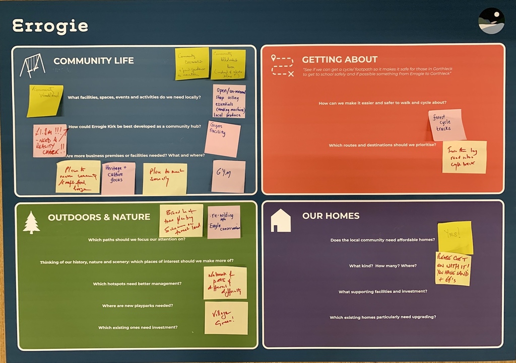
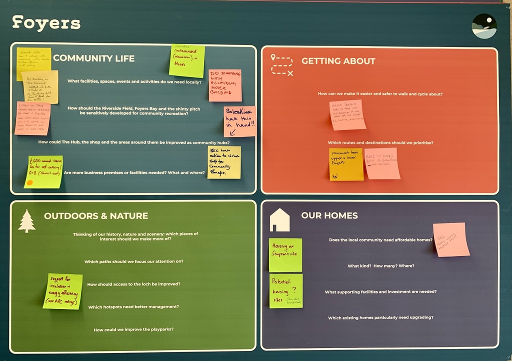
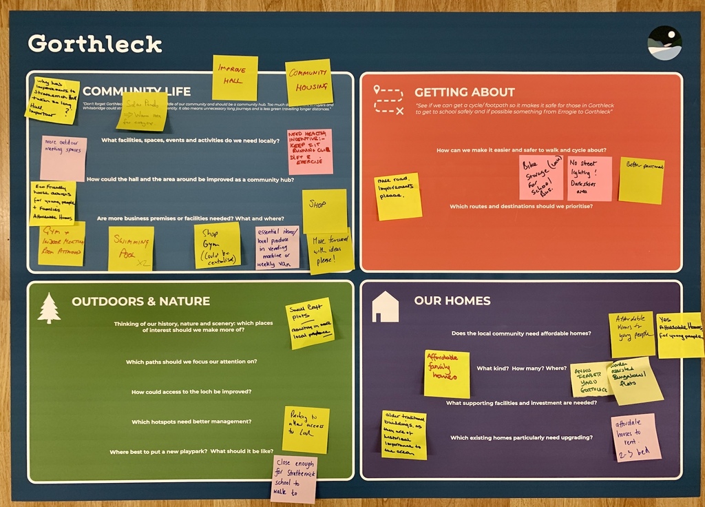
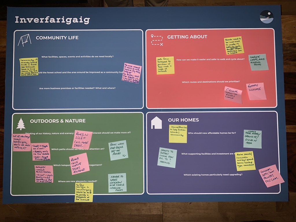
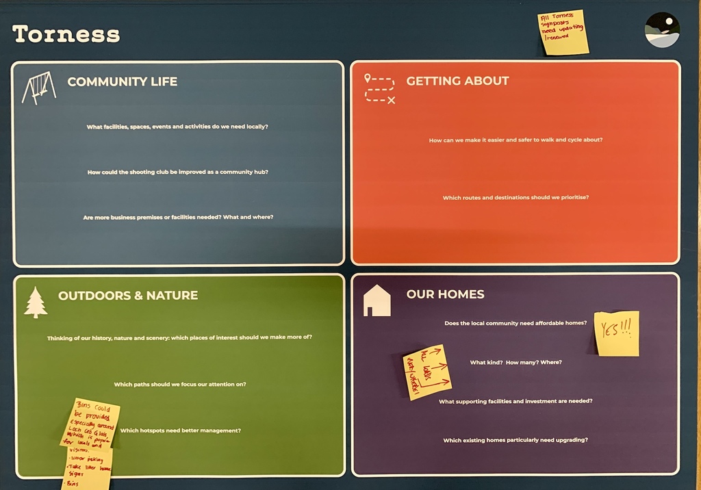
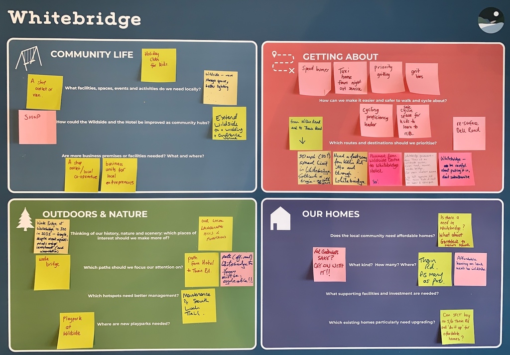
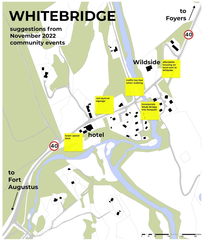
First up are the posters for each settlement in the area: Errogie, Foyers, Gorthleck, Inverfarigaig, Torness and Whitebridge. Some of those also have maps with comments, and there's a 'community-wide' poster too.
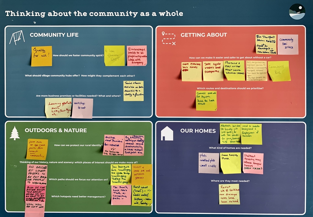
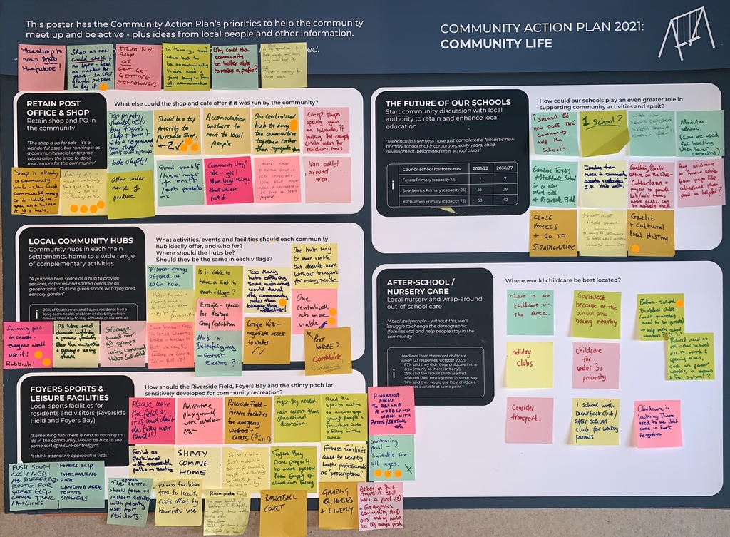
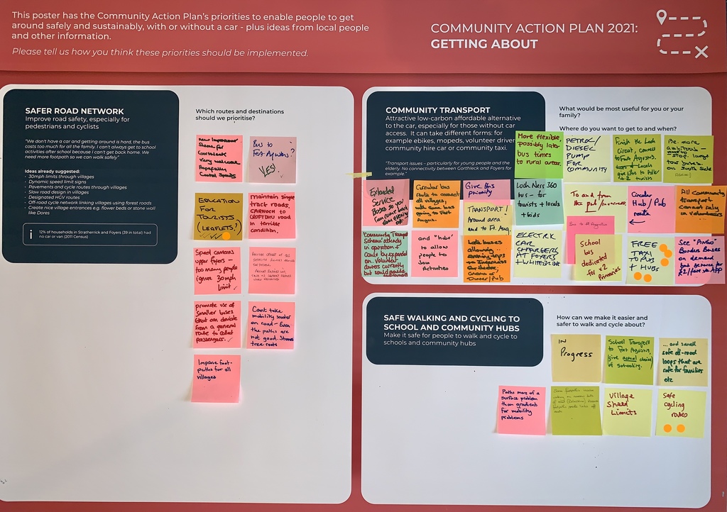
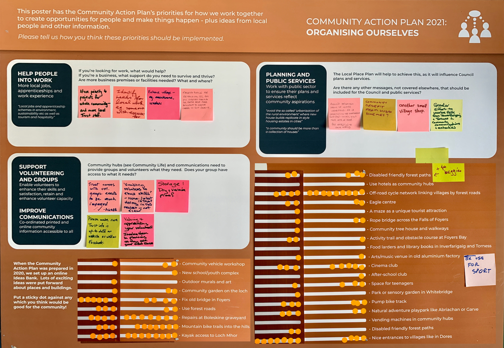
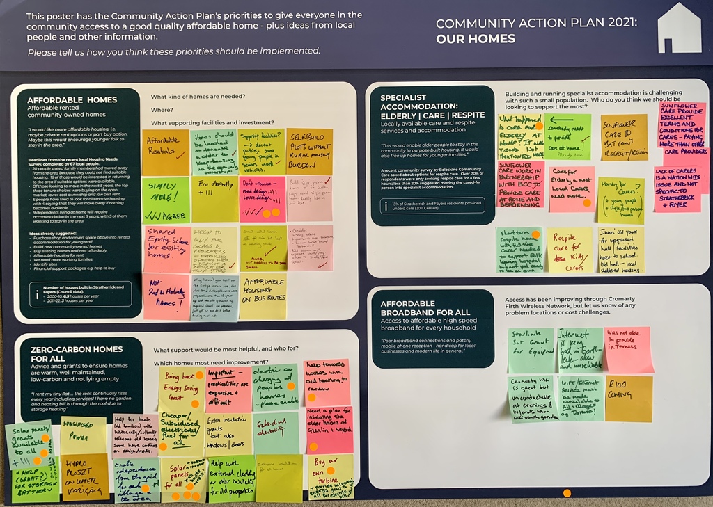
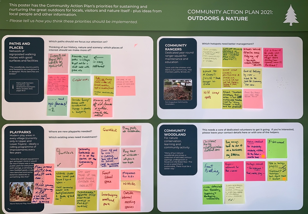
Beneath those, you'll see the posters for each of the five Community Action Plan themes: Community Life, Getting About, Organising Ourselves, Our Homes, and Outdoors and Nature.
If you look carefully at each poster, you'll see printed questions. The handwritten sticky notes are people's responses to those questions.
Don't forget, you can see full transcriptions of all the handwritten comments in this report. If you have any questions, please contact Nick Wright (nick@nickwrightplanning.co.uk, 07900 334110).
SETTLEMENTS
Errogie errogie comments.jpg724 KB
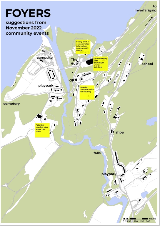
Foyers foyers comments.jpg834 KB foyers map with notes.jpg1.48 MB
Gorthleck gorthleck comments.jpg955 KB
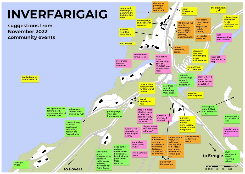
Inverfarigaig inverfarigaig poster with notes.JPG742 KB inverfarigaig map with notes.jpg1.11 MB
Torness torness comments.jpg633 KB
Whitebridge whitebridge comments.jpg794 KB whitebridge map with notes.jpg1.11 MB
Community-wide community as a whole.jpg2.77 MB
THEMES
And here are the comments that people left on the five themes in the Community Action Plan:
Outdoors and Nature outdoors and nature.jpg3.14 MB
Bob Main
2003/4 was possibly the last time the Foyers shinty pitch suffered from "natural" flooding. It was flooded to a much greater extent on the 8th March 20015 when the canal breached near the Abercalder swing bridge and emptied in to the river. However it does confirm it's susceptibility to being inundated.
The field was uneven due to settlement or expansion of buried fill. A number of boreholes were installed so that leachate from the smelter waste in to groundwater could be monitored. I don't know where the data is held but the word was that there is not a problem. (The CC?). More recently surface contamination came from a huge volume of water and silt which washed down when the penstock ruptured near Craigdarroch. I don't remember the date.
Craig Lightbody
The map of Foyers has a post-it note attached, stating that the shinty field floods and is contaminated. I don't know where this information came from but clearly can't be corroborated.
The last time this field flooded was 2003/4 during a '100 year' flooding event which affected all communities around Loch Ness.
No one seems to be able to explain what contamination is in the field nor how it is monitored.
The above link, 'This report' doesn't open and so the transcribed comments can't be read.